Datasets
Choose this theme to customize and add content to this page.
gridmET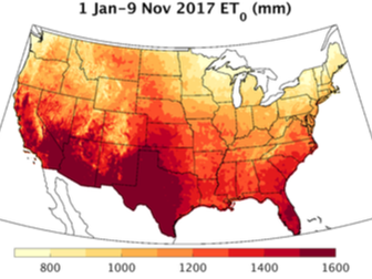
gridMET is a gridded surface meteorological dataset covers the continental US from 1979-present mapping surface weather variables at a ~4-km resolution. This dataset is updated daily.
|
TerraClimate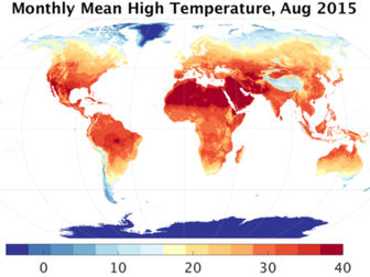
TerraClimate is a high-spatial resolution (~4-km) gridded dataset of monthly climate and hydroclimate for global land surfaces from 1958-present. This dataset is updated annually.
|
MACAMACA is a statistical downscaling procedure we developed was applied to output from CMIP5 models to produce daily ~4-km resolution grids of surface meteorology across the US.
|
Seasonal climate forecastsDownscaled seasonal climate forecasts for the 7-months from models participating in the North American Multi Model Ensemble (NMME). Data are updated monthly.
|